Spring was tempestuous with every kind of weather imaginable, sometimes all within one day. After several sunny, warm days in early May, it felt as if spring had arrived, and I drove up to Flathead Lake in the hope of seeing the cherry orchards abloom. On the way up, the vista is a palette of greens, from the soft yellow-green of newly leafed trees, to the verdant grasses, and the forest green of pine trees climbing the mountainsides.
Along HWY 93, there is a grade that’s gentle at first, and then gets steeper. For a moment it’s just road and sky, and then, suddenly, the jagged tops of the Mission Mountains burst over the horizon. It took my breath away.
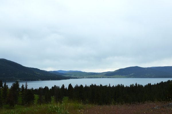
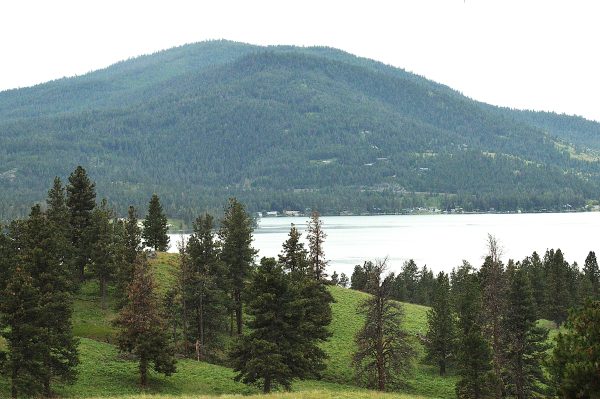
I had the same sense of amazement when I arrived in Polson and glimpsed Flathead Lake. The blue of it- teal near the shore, deeper blue in the distance, was the color of a clear sky, which it was that day.
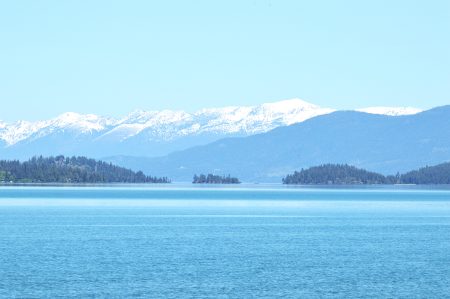
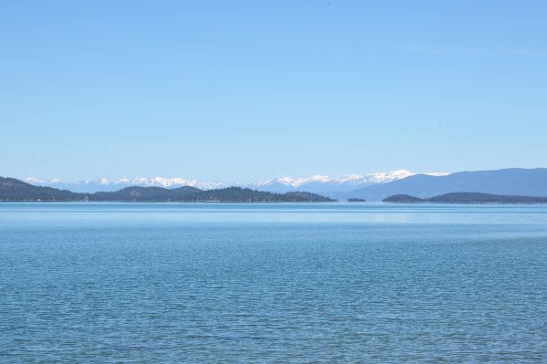
Flathead Lake is the largest freshwater lake west of the Mississippi River, and is one of the clearest lakes in the United States. It has two hundred square miles of surface area, one hundred eighty-five miles of shoreline, and a depth of three hundred seventy feet. There are a dozen small islands within the lake. Wild Horse Island is the largest at 2,164 acres of rolling hills, the highest of which is 3,749 feet. The Salish and Kootenai people used this island to pasture their horses to protect them from being stolen by other tribes. Wild Horse Island was designated a state park in 1978.
The lake is at the southern end of the Rocky Mountain trench, and is the remainder of glacial Lake Missoula. It is bordered on the east by the Mission mountains and by the Salish Mountains on the west. This ecoregion is rich in biodiversity and includes large mammals such as the grizzly bear and the black bear, elk, white tail deer and mule deer, moose, mountain goats, gray wolves, and mountain lions. Its climate is favorable for cherry orchards on the east shore and vineyards on the west shore. Apples, pears, plums, vegetables, hay, nursery and Christmas trees, sod, wheat, and canola are produced around the lake. It is known for recreational activities that include fishing, sailing, boating, water skiing, swimming, picnicking, and camping.
And then there is Flossie, a giant serpent like creature reported to inhabit Flathead Lake. Since 1889, there have been one hundred nine documented sightings of this twenty to forty foot long creature. She was last seen in the fall of 2017.
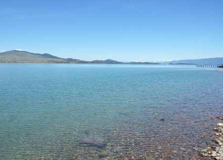
Walking along the crystalline shoreline, I read the placards with stories of Native American life before the Europeans arrived, and imagined what a paradise this must have been.
Archaeological discoveries indicate that western Montana had been inhabited by humans for twelve thousand years before the Lewis and Clark Expedition traveled through the Bitterroot Valley in 1805. It was the first written record of European contact with the Salish people who lived there. Settlers arrived for the gold rush of 1864, along with the Missoula and Bitterroot Valley Railroad, forcing the Salish out. Soldiers marched the Salish people, who were suffering from starvation, sixty miles from Fort Missoula to the 1.3-million-acre Flathead Reservation. Twenty-two million acres of the Salish homeland were yielded to the United States. The Flathead Reservation is home to the Bitterroot Salish, the Upper Pend’ Oreilles, and Kootenai tribes.
All but the northern end of Flathead Lake is in the Flathead Reservation.
After a long walk, I drove around the cherry orchards, but there were few blossoms. A cold spell in mid-January with temperatures as low as minus thirty-two degrees caused the flower buds to freeze, and in some areas caused damage to the trees. This has had an unfortunate impact on the cherry season. It is anticipated that the harvest of the sweet and juicy cherries will be lower than normal.

Wild Horse Island
When I learned that five wild horses lived on and roamed the island, I knew I had to visit it. I’ve always had an affinity for horses. To me, they are the most elegant animal, even in the wild, and that’s the way I love to see them, wild and free. So, in early June, I made another trip to Flathead Lake, this time to drive around the perimeter of the lake, as well as to visit the island.
After a string of sunny, summerlike days, I woke to a chilly, overcast morning, but spring was in full bloom and the landscape was even more beautiful than the last time I drove on Hwy 93. The Mission Mountains startled me again when they emerged above the road, now covered with fresh snow from a storm in late May.
The drive around the lake reminded me that agriculture is Montana’s main industry. Cattle grazing in fields and trucks driving by with rolled bales of hay contrasted with the recreational aspects of the lake: people fishing off the sides of sailboats; motorboats and pontoon boats darting across the open water.
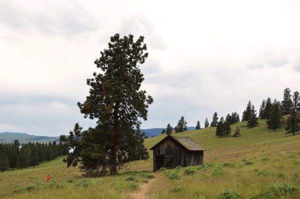
When I walked in the door at Big Arm Boat Rentals for the three o’clock shuttle to Wild Horse Island, I was warmly greeted by Matt, the owner. He tells me and the other passengers, Rick and Rachel, about points of interest, instructs us to take to take a photo of the map of the island at the landing, and that we will be picked up at 6:30.
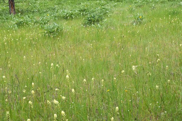
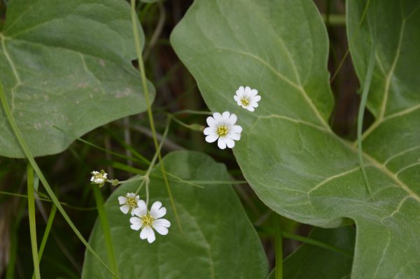
It’s a twenty minute pontoon ride from Big Arm to Wild Horse Island. When we arrive, we snap photos of the map. Rick and Rachel go left toward the high point of the island, and I make my way up the path towards my adventure. Walking through the Pondersoa pines, I was enchanted by the abundance of white wildflowers. It looked like a faerie garden. When I did a search of these lovely flowers, I learned that they are called Death Camas. They are pretty to look at, but poisonous.
When I emerged from the forest, I met a couple with two little girls. I asked one of the little girls if she’d seen the horses. “No,” she said, “only butterflies.” She ran up the hillside with her sister, her parents in pursuit.

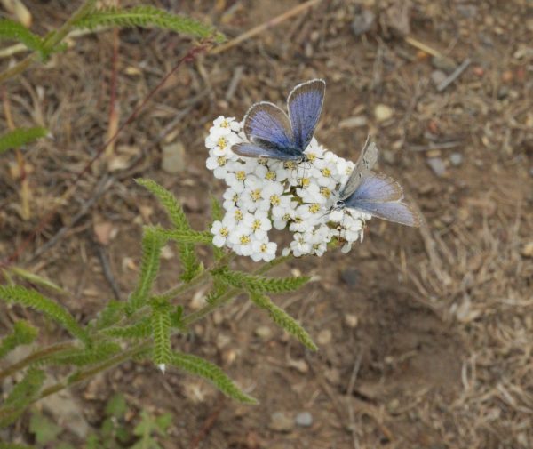
I followed a path that ended in a clearing where there was a flutter of periwinkle blue butterflies. Their gossamer wings were vibrant on that overcast day, and I was spellbound as they danced in the air. These lovelies are Celastrina Ladon Lycaenidae or Spring Azure butterflies. They are tiny, with a wingspan of 0.87” to 1.8.” Their habitat ranges from the Alaskan Tundra to mountainous areas of Colombia, and are widespread throughout the U. S. They can be found in old fields, clearings, and at the edges of forests, wooded marshes, and freshwater swamps. When two of them settled on a yarrow flowerhead, I managed to capture this photo. Doesn’t it look as if the one on the right is looking into the camera?
I walked through a grassy meadow keeping an eye out for wildlife, especially the wild horses who inhabit the island. The rolling hillsides are hip high with native grasses interspersed with wildflowers: yarrow, field chickweed, death camas, blanketflower and arrowleaf balsam root. The deer and big horn sheep like to eat the flowers of the arrowleaf balsam root plants.
I cross paths with hikers who say they spotted two bighorn sheep, but no horses. Although I scanned high and low, there was no wildlife in sight. The cloud cover turned dark, and it began to rain.
Higher up, the views are spectacular. There’s a rusted marker, on it is written “loop” with arrows pointing in opposite directions. Needing to decide which way to go, and since I’d come from the left and the loop from the landing point had two ways to go, I thought by going right I’d make the complete loop, so right I went.

What is that? Two horses in the distance? I take out my camera shaking with excitement, and look through the viewfinder. As I adjust the focus, I realize that it is a tree stump and fallen branches.

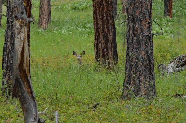
Now I’m walking through the forest, still hoping to see the horses, but intent on arriving at the landing on time for pick up. I feel as if I’m being watched and look around. I see a deer lying in the grass, studying me. I look back and feel a connection with it. The deer stands up, and then another stands beside it. There is one more deer in the photo. Can you see it?

They watch me until I reach the cove. The beach doesn’t look anything like the one where we landed. I looked at the map there and saw a star at Eagle Cove. I looked at the map on my phone and saw all the landing sites, but there are no stars on any of them. I don’t know where I’m supposed to be.
I called Matt to tell him my situation. He says to stay where I am and his son, Kenton, will pick me up. Soon enough, Kenton arrived in the pontoon, and piloted us back to Skeeko Bay where Rick and Rachel waited. They were excited to say that they witnessed the mama Bald Eagle in the nest above us swoop into the bay, catch a fish, and feed it to her two chicks.
The clouds thinned and revealed patches of blue sky. We chatted as Kenton steered us back to Big Arm. He’s majoring in Biomedical research. “I love science and math, and I’m interested in the brain.” He said he’s impressed with the work Neuralink is doing, referring to the YouTube video of Neuralink’s first research participant, playing chess with thoughts transmitted to a computer.

I stopped in Polson for dinner, and by the time I left the restaurant, cumulonimbus clouds were scattered across the big sky. I drove south on HWY 93 appreciating what a wonderful day it had been. I didn’t see the wild horses, but I walked through a landscape filled with wildflowers and exquisite butterflies, a herd of deer of acknowledged my presence, and I saw a mother eagle sitting proudly on her nest with one of her chicks. I also got to hear the dreams of a young man filled enthusiasm about the future.
As I drove along the wetlands, the setting sun cast its last rays on the Mission Mountains, and the whole valley was filled with golden light. It was magical.
I will go back again to look for the horses, and maybe I’ll catch a glimpse of Flossie.