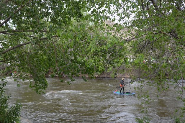
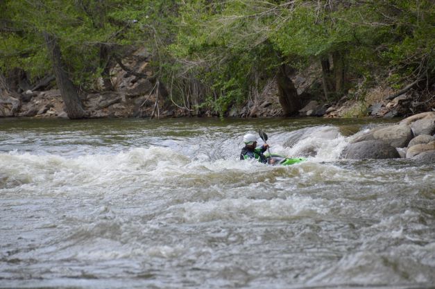
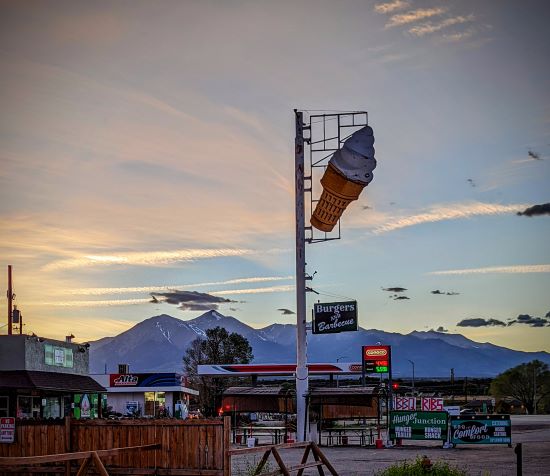
Cortez, CO was one the places that fascinated me on my journey last year. The area is rich in the history of the ancient Anasazi who dwelt there. I decide to return to see what I missed. On the way there, I stop in Poncha Springs to charge Freedom at the Tesla Supercharger and while away the afternoon in Salida. It’s a lovely day and I enjoy walking along the Arkansas River, watching the white water rafters and paddle boarders glide by, and kayakers play in the waves. What impresses me most is the number of dogs I see. There are dogs along the river, in the river, in the park, on the street, even in the restaurant where I have lunch. Except for the dogs in the river, they’re all walking people on leashes. In all of my travels, I’ve never seen so many dogs in a vacation spot. I’m so astounded by this phenomenon that I fail to photograph it.
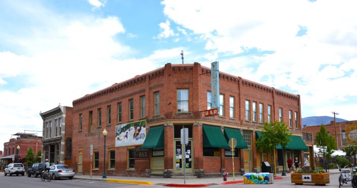
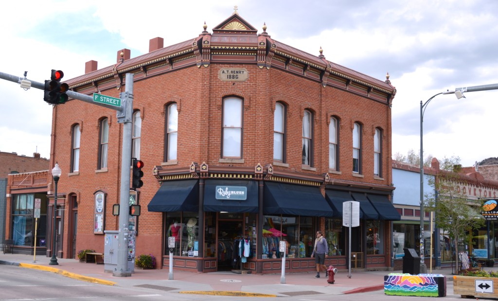
Salida is a lovely town, and aside from river sports, it is known for its indoor hot springs that come from Poncha Springs eight miles up the road. Eighty years ago, the WPA capped those springs and diverted the flow to Salida.


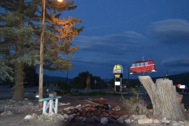
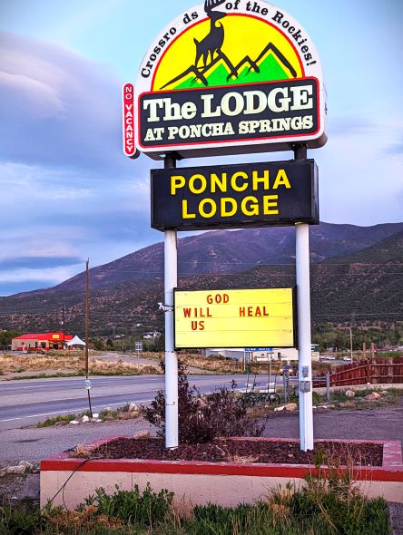
Ah, Poncha Springs. I don’t know why I feel that if I were ever to encounter a UFO, it would be here. There isn’t much to do, but there’s lots of open seating.


HOVENWEEP
When pioneer photographer William Henry Jackson came to the mesa in 1874, he called it Hovenweep, the Ute/Paiute word meaning deserted valley, but it had been inhabited over thirteen thousand years ago by nomadic hunters who roamed these plateaus and canyonlands. As the animals they hunted moved elsewhere, they followed. Eleven thousand years ago, hunter-gatherers from the west moved in. These people, the Anasazi, are the ancestors of the Pueblo people. They moved around according to the seasons, taking shelter under canyon ledges and in narrow recesses as they searched for food. When they began to grow corn, life became more ordered, and they built pit houses in the valleys and mesas near their crops.
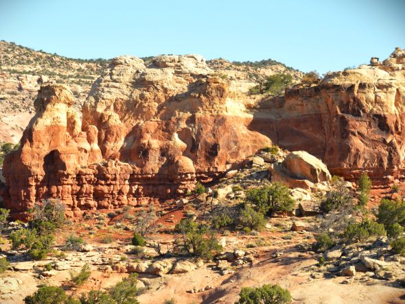
Cajon Mesa, was a source of water with springs and seeps. The ancient Pueblo people grew the Three Sisters: corn, beans, and squash, and other crops, in fields and terraces, building check dams for irrigation. Around the year 700 CE the population in surrounding areas grew. As people moved away from mesa top homes, larger villages were built around Hovenweep.
Severe drought, over use of natural resources, and over population in the late 1200s caused the Pueblo people to leave the area and settle in the Rio Grande area of New Mexico and the mesas of Arizona.
Hovenweep was designated a national monument in 1923.
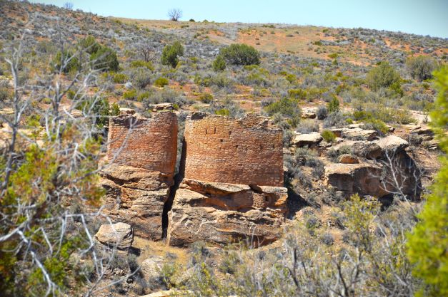
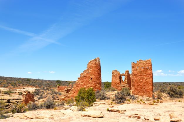
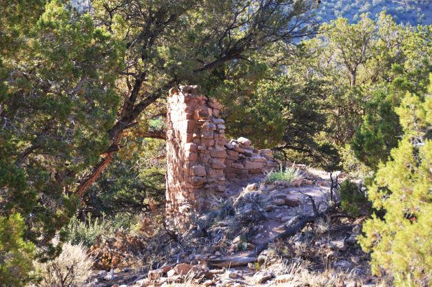
The two towers are constructed on bedrock with thick and thin sandstone blocks. One tower is oval, the other is horseshoe shaped. There are sixteen rooms between them. The towers are among the most skillfully constructed buildings in the southwest.
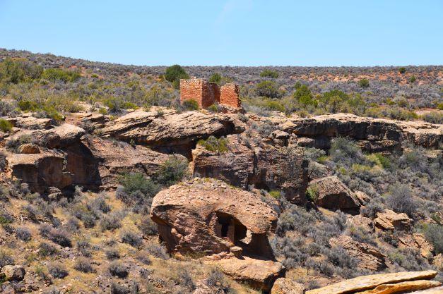
The rectangular structure is two stories tall. It may not have been used to live in, as there are no room divisions. There are many small openings at unusual angles whose function is unknown.
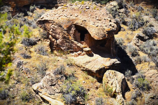
Below it is Eroded Boulder House. Walls were built incorporating parts of the rock for its roof and walls.


Unit Type House has a few living and storage rooms and one kiva, a room for spiritual ceremonies. The structures are maintained by the Pueblo people, but if a structure collapses, it is not re-built.
Tower Point views the entire Little Ruin Canyon. Recesses below the rim were used to store crops. Rim Rock House is across the canyon.


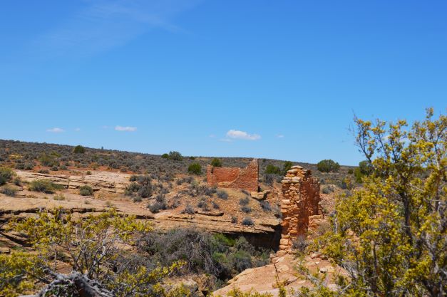
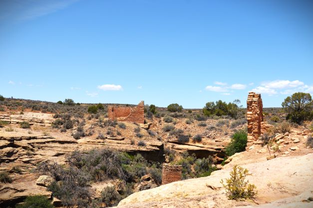

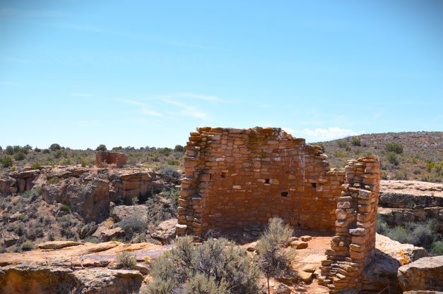
Hovenweep Castle consists of two D-shaped buildings, the stone walls, two and three rows thick, show comprehensive masonry skills. The Square Tower is situated in the canyon, built on a sandstone boulder in a slightly spiral shape. A kiva was excavated beside it. The large Hackberry trees growing there indicate the seep underneath, designating the water source that was vital to the settlement.

Park Ranger Steve makes sure everyone and everything is okay.

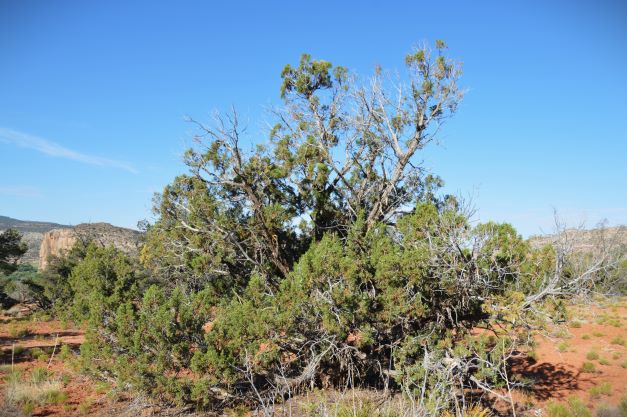
Just beyond the Castle and Square Tower is this lovely Juniper tree. It’s the largest Juniper I’ve seen in my travels around the southwest. It’s one hundred degrees, and it’s a treat to sit and sip water on a bench under its shade. It’s silent, except for a gentle breeze and the occasional bird song. Although I encountered other visitors along the way, I am alone now, breathing the fragrant Juniper, and feeling at peace.
I think about the ancient people who lived here, the ingenuity and skill it took to build these extraordinary structures, and to live in harmony with nature under severe conditions. Still, they were driven away by conditions similar to what we are facing today. I can’t help feeling that there are lessons here for us.
Sleeping Indian Mountain
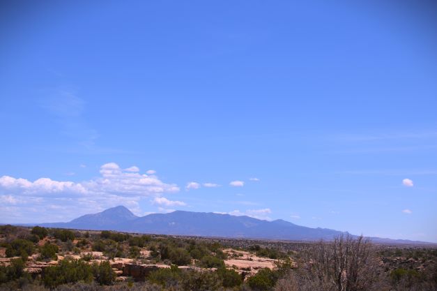
There is a Ute legend that the Great Warrior God came to help his people fight evil. There was a great battle, and though victorious, the Warrior God was wounded. He lay down to rest and fell into a deep sleep. His open wounds became rivers. It is said that he changes blankets for the four seasons; light green in spring, yellow and red in fall. Some Utes believe that one day he will rise to help his people.
Anasazi Heritage Center
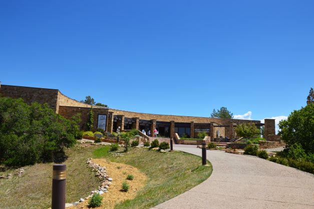
Canyons of the Ancients National Monument comprises 170,000 acres in the southwest corner of Colorado. Its landscape is rich in cultural and natural resources, and managed by the Bureau of Land Management’s National Landscape Conservation System. Monument headquarters are at the Anasazi Heritage Center.
The visitor center and museum focus on Ancestral Puebloan, Native American, and historic cultures in the Four Corners region. The exhibits feature the methods that archaeologists use to reveal the past. There are interactive, computer based exhibits, artifacts from excavated sites that you are able to touch, and a replica of a furnished Pueblo pit house.
It is also a repository for artifacts and records from excavations of 1,626 archaeological sites on more than 16,000 acres, 125 sites were fully excavated, and more than 1.5 million artifacts were collected. The Heritage Center was constructed not only as a museum, but also to preserve both artifacts and records in perpetuity. It offers educational resources for teachers, internships for students and recent graduates, and a research library of archaeology and anthropology. Archaeological reports are available for download in searchable PDF format for anyone with a legitimate research interest through the curation department.


It’s an easy walk up to the Escalante Pueblo, where there is a three hundred sixty degree view of the area. It looks on McPhee Reservoir, and out towards the Sleeping Indian Mountain.
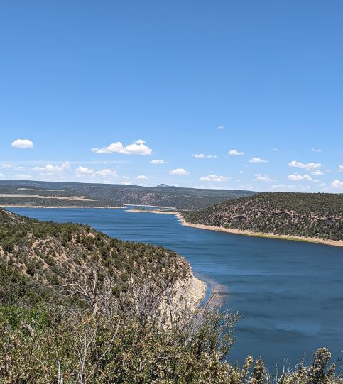
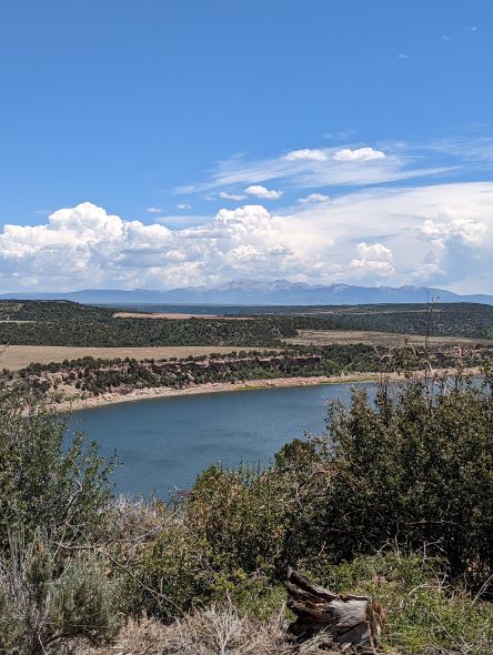
McPhee Reservoir dams the Dolores River to provide irrigation water for Montezuma and Dolores counties, and the Ute Mountain Ute Indian Reservation. There are campsites and boat ramps as well as fishing, and hiking and biking trails.
Sand Canyon
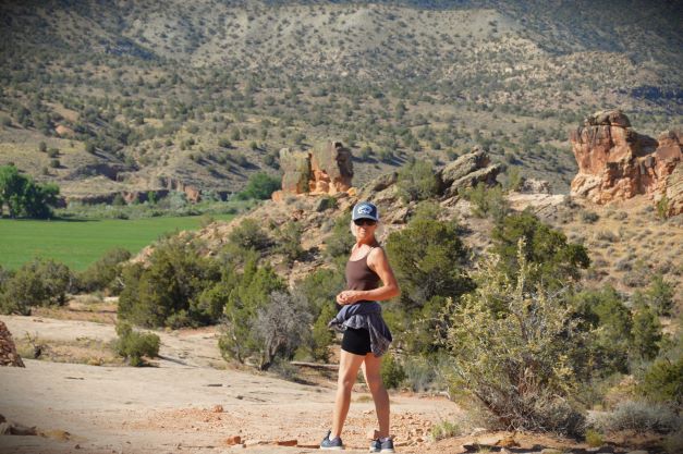
When I visited Sand Canyon last year, I went along the upper ledge. The climb down was steep and there was no one else around. I thought it wise not to attempt hiking it alone. I promised myself that I’d come back and take a closer look. This time I went with my friend, Pauline, who lives in Cortez and knows the area well.
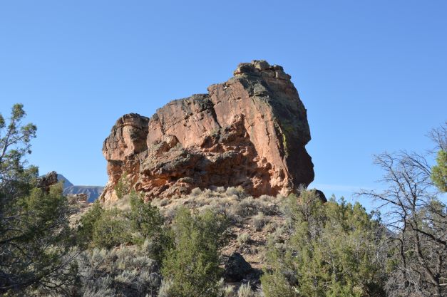
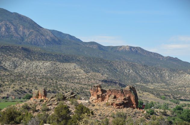
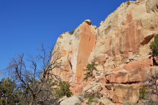
McElmo Road runs along the foot of the Sleeping Indian Mountain. Because of run off from the mountain, this area is green and fruitful. There are orchards and even a vineyard, and looks lush compared to the slip rock trailhead to Sand Canyon. The first great rock is Castle Rock, but it looks like an elephant to me.

Just past Castle Rock, there is a spur trail that leads past a large section of preserved wall. There is a slow rise on the path to a junction with a path that leads to views of the ruins.
About 1250 CE, a large, compact village was built at Sand Canyon. By 1275 CE Sand Canyon was about three times the size of Cliff Palace at Mesa Verde. The onset of severe drought resulted in poor or failed crops. In 1277 CE, Sand Canyon Pueblo came under attack, perhaps by other Pueblo people competing for dwindling resources. Many people were killed. Afterwards, the survivors migrated away.
When archaeologists worked at Sunny Alcove, they found corn cobs, pottery sherds, and fragments of grinding stones. The well-preserved walls include eight rooms and a kiva.


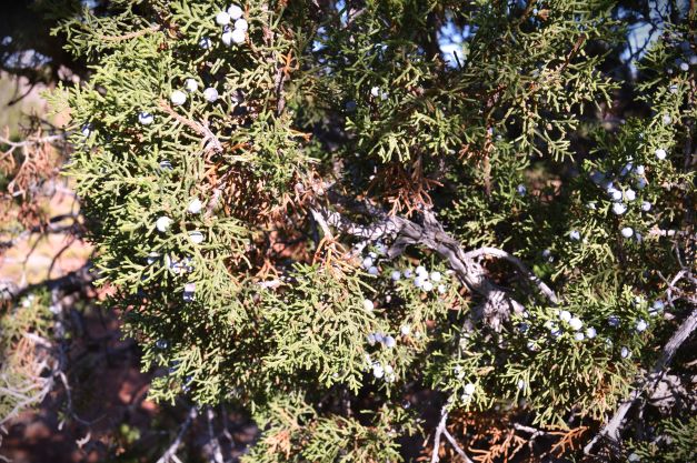
I have grown to love Juniper trees. They are capable of surviving in harsh climates and inhospitable landscapes, in scorching heat, and with little water. They often appear to grow out of solid rock, and a tap root can penetrate down twenty-five feet in search of water. They live in almost every continent in the world, and is one of the oldest living species of trees. During my visit to Escalante Pueblo, I learned that during drought, Junipers will cut off access to water to some limbs for the survival rest of the tree. Native Americans use the seeds as beads to make necklaces and bracelets for protection. The berries are edible and medicinal, and are used to make gin. I like my martinis with a twist of lemon.
Pauline is the owner of Bella Organique Spa and Airbnb. She is a former Olympic skier, a gifted gardener, and extraordinary body worker. If you are ever in Cortez, and need a place to stay, contact Pauline. Treat yourself to a deep massage. You’ll be glad you did.

Thank for sharing all this great information. Love it all. In anchorage, Alaska the have the Sleeping Lady Mountain. The legend has it that when she rises there will be peace in this world.
LikeLiked by 1 person
I hope she rises soon!
LikeLike
Great photos as usual. How do you remember all that info? Love that the dogs walk the people! That’s because dogs are smarter than people.
LikeLike